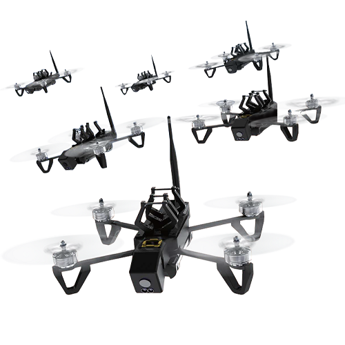

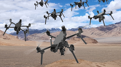
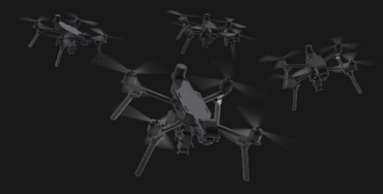
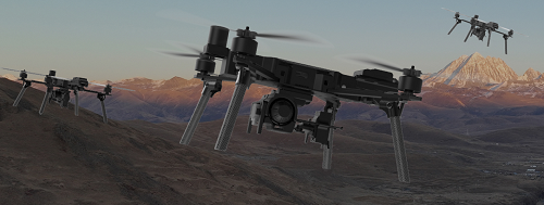
A swarm drone, also known as a drone swarm, is a group of small unmanned aerial vehicles (UAVs) that are designed to work together towards a common goal. They can perform various missions such as reconnaissance, strike and jamming.
Tactical Innovation Intelligent Strike: Bee Colony
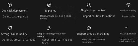
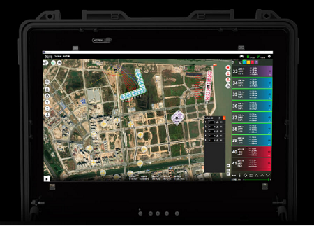
One person, one station can achieve multi machine control
The formation supports various formations such as horizontal/vertical/triangular and encirclement, and supports multiple formation settings. It can be split and combined into different formations in real time to perform tasks separately, without the need to plan specific paths. One click formation instructions can be implemented
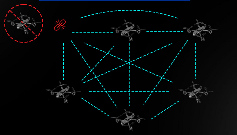
Strong resistance to destruction without a center
The bee colony has no central node, and if a single machine is damaged, other machines will automatically replenish their positions. The overall formation can be maintained and tasks can be executed
Target AI intelligent recognition and tracking
AI intelligent support, supporting autonomous target recognition and continuous tracking, achieving visual guidance function
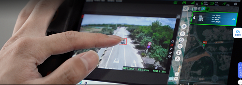
Support importing coordinates from other devices
Support importing coordinate information from radar, other drones or devices into the swarm to enhance collaborative combat capabilities
Support optional extended throwing module
Linked with AI vision systems, it can achieve high-precision delivery by following specific formations or directly targeting a single target point.
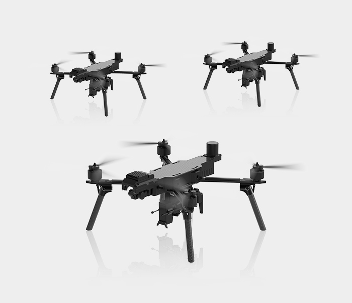
Technical parameters:
Overall dimensions: 575 * 522 * 205mm (length * width * height)
Folding machine size: 443 * 238 * 108mm (length * width * height)
Maximum takeoff weight: 4.6kg
Maximum load capacity of 2.3kg
Maximum level flight speed: 30m/s
*The parameter values listed on this page may vary depending on the environment, usage, or firmware version. Please refer to the actual usage for accuracy;
1. The maximum endurance time and actual flight time may vary depending on the flight mode, load, and environmental conditions; Please monitor the status of the aircraft based on real-time prompts from the ground station;
2. Image transmission distance is the performance data of an aircraft flying at an altitude of about 110 meters in an unobstructed and moderately strong interference environment according to FCC standards, for reference only; Please note that actual flight performance may vary due to differences in environmental occlusion and interference levels; Please closely monitor the real-time prompts from the ground station to ensure flight safety and efficiency.
3. The actual wind resistance may vary due to changes in flight altitude, wind direction, aircraft load, and other external conditions. Please refer to the actual use.
6M-QN drone bird repeller is a self-developed and produced drone-mounted birdrepellent product. lt consists of tweeter, ultrasonic speaker, camera, 3600 rotatingstrobe spotlight and others. lt can work day and night. lt is compatible with varioustypes of flight platforms in the market.
Details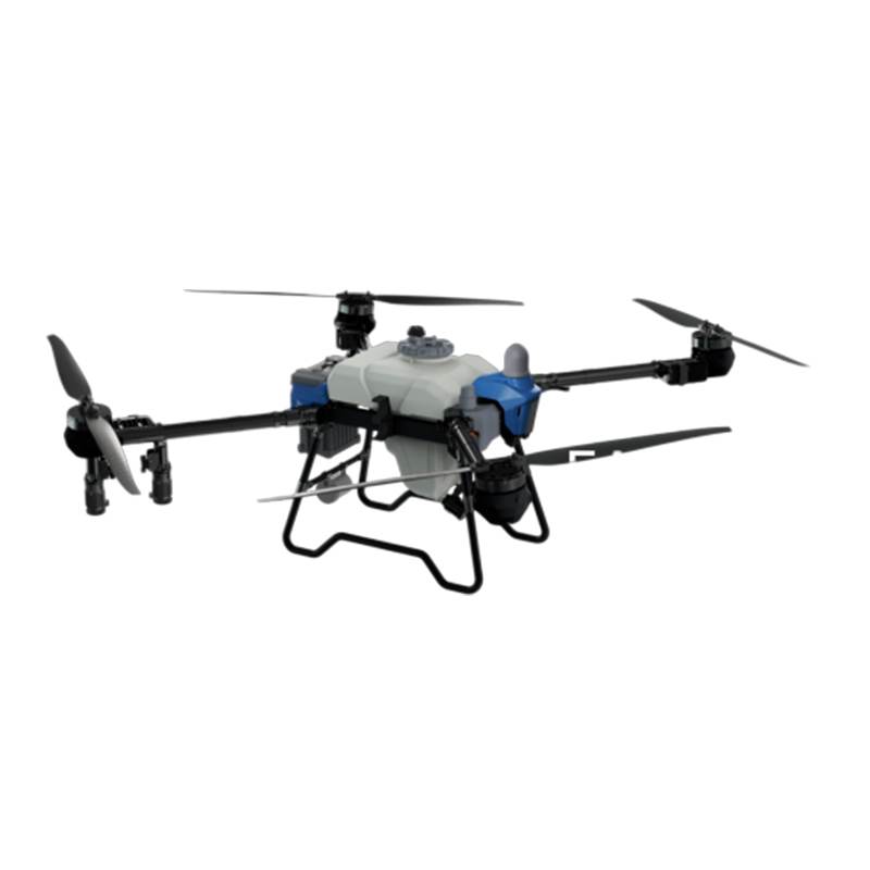
This agricultural drone with 360° obstacle avoidance integrates advanced laser radar and AI vision, achieving 150m range crop spraying UAV operations even in dense orchards. The laser radar plant protection drone detects 2cm-thick branches and power lines with millimeter precision, while its wide-angle pest control system ensures 98% chemical coverage on irregular terrains. Designed for smart farming drone applications, it supports autonomous route planning to avoid collisions during orchard spraying. As an autonomous agricultural drone with anti-collision tech, it reduces operational risks by 70% compared to traditional methods, making it ideal for vineyards, tea plantations, and sloped farmlands.
Details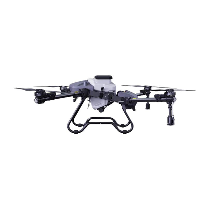
This high-flow agricultural spraying drone revolutionizes modern farming with its dual-mode crop seeding UAV system, seamlessly switching between 30L/min pesticide spraying and 50kg/h granular seeding. Powered by 56-inch propeller plant protection blades, it delivers unmatched stability even in 8m/s crosswinds. The water-cooled centrifugal nozzle technology precisely controls droplet size from 50-300μm, while the integrated ultrasonic flow meter ensures ±1% dosing accuracy. Designed as a durable agricultural drone for large-scale fields, its all-metal dispersion disc withstands 10,000+ hours of abrasive operations. From rice paddies to cotton farms, this precision farming drone reduces chemical costs by 35% through AI-powered terrain adaptation.
Details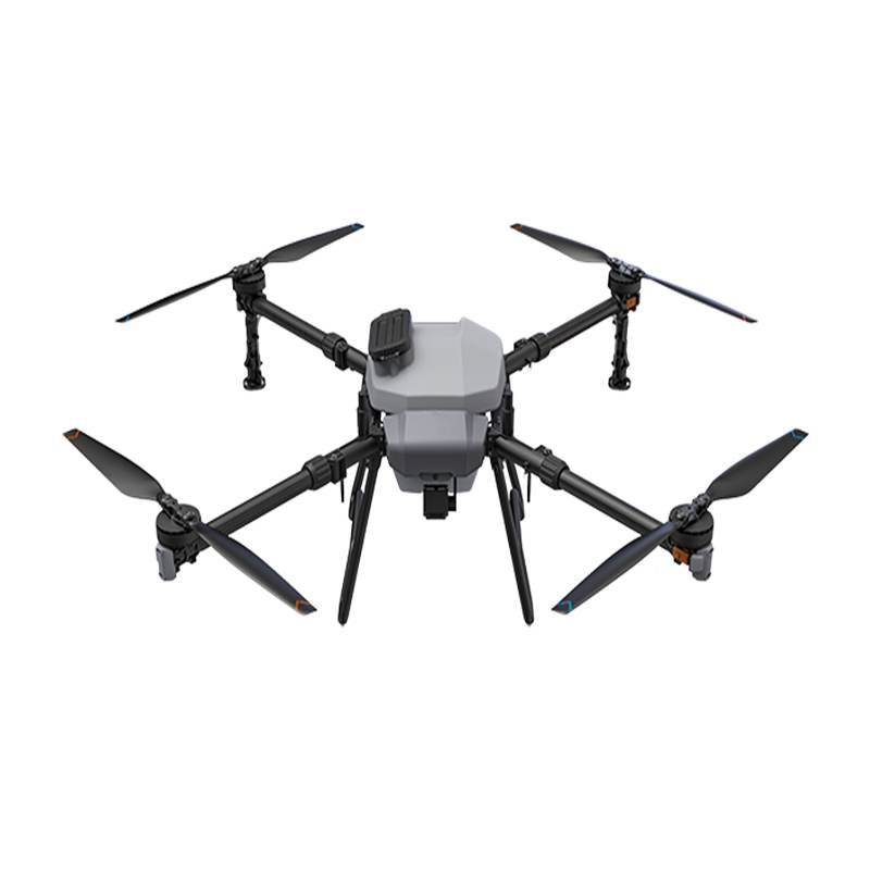
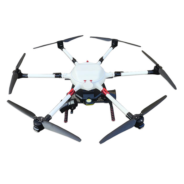
Agriculture drones are mainly used in agricultural pesticide spraying, sowing, fertilization and other scenarios. After multiple upgrades and iterations, they have reached the leading level in practicality, reliability, safety and other aspects in the industry. The whole body is waterproof, dustproof, and corrosion-resistant, and some key modules such as the spray system, radar system, and power system have reached IP67, making it easy to clean and maintain. The dual redundant positioning system can achieve centimeter level high-precision positioning and support dual antenna anti magnetic interference direction finding technology. Equipped with a wide-angle FPV camera and a high-definition digital image transmission system, it can observe the working environment ahead in real time.
Details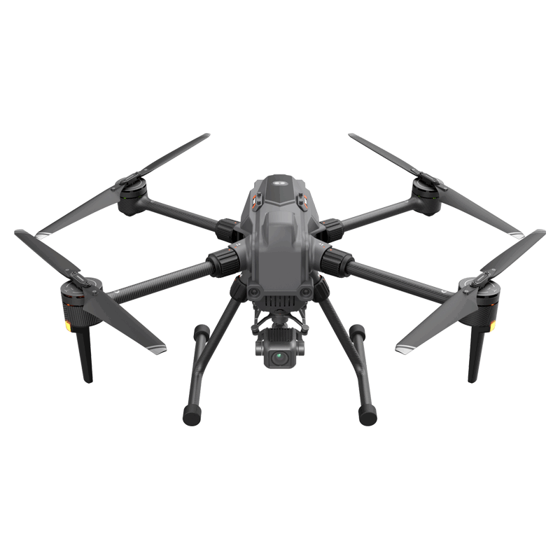
This drone adopts a folding structure, which is easy to store and carry. It has autonomous flight capabilities such as automatic cruise control, intelligent recognition and tracking, automatic return, and automatic precise landing. At the same time, it is equipped with visual assisted positioning and visual omnidirectional obstacle avoidance functions, providing a safer and more stable flight guarantee for the drone. Besides, this drone can adapt to multiple payloads and easily meet the complex application needs of different industries and scenarios.
Details
Powerful power system design, more comprehensive industry application load, ultra long endurance, using industry-leading domestic eight core chips, with a total power of 21T, possessing strong visual intelligence AI recognition ability, can achieve cloud edge collaborative operation streamlined body design, compact and portable, and powerful performance.
Details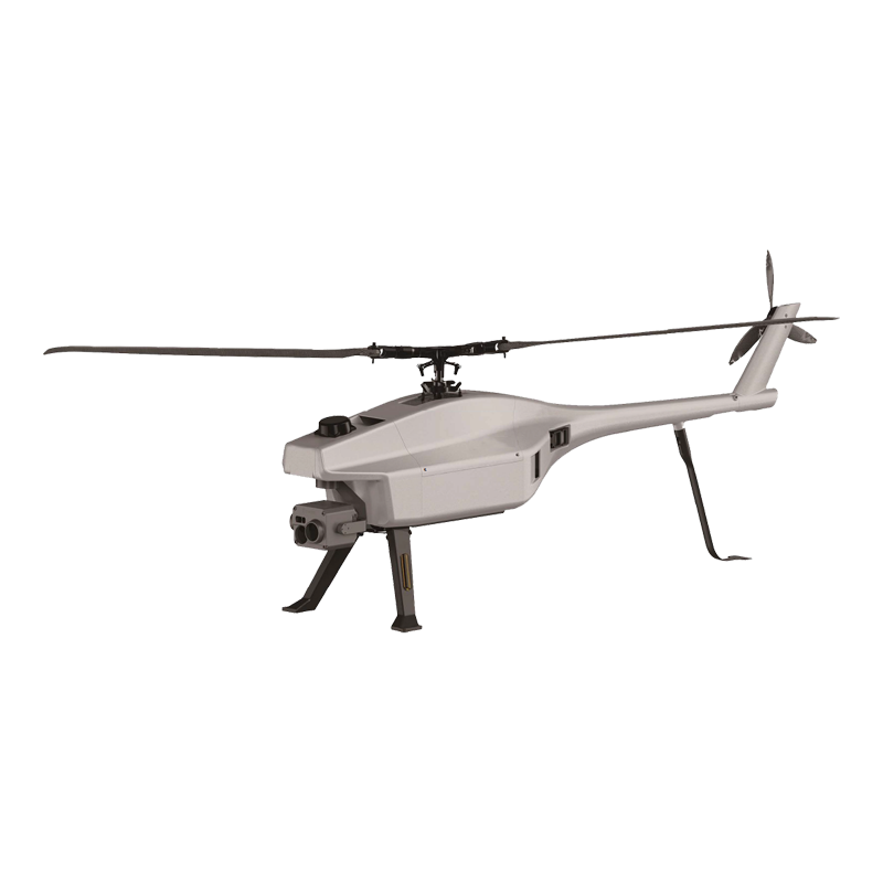
It has the advantages of ultra-long endurance, mobility and flexibility, single person portability, rapid deployment and intelligent control. In the field of public security, it can effectively improve the efficiency of urban security management, and in natural disasters, it can quickly respond and provide key information, while it performs well in complex terrain and adverse weather conditions.
Details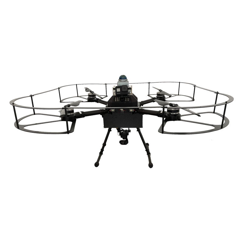
This UAV only needs to be observed and remotely controlled by a pilot on the ground, avoiding the risk of manual inspection and improving the safety of the operation. Meanwhile, based on Li DAR technology, it can smoothly fly autonomously in indoor and underground environments without GNSS data information, and can comprehensively scan the top, bottom and surface of indoor and tunnel areas without dead corners. Build HD model image data. In addition, the whole UAV is equipped with a cage anti-collision structure, which effectively guarantees the safety of the UAV during flight, and can be used in a variety of environments such as highway tunnels, tunnel passages, and indoor environments.
Details
With its advanced anti-interference, long endurance, compact size and powerful power system, as well as stable communication and navigation performance, this high-speed UAV has become an ideal choice for patrol tasks. Its advanced sensors and cameras can monitor targets in real time, and flexibly configure various functions according to task requirements, which provides great convenience for patrol work.
Details
A swarm drone, also known as a drone swarm, is a group of small unmanned aerial vehicles (UAVs) that are designed to work together towards a common goal. They can perform various missions such as reconnaissance, strike and jamming.
Details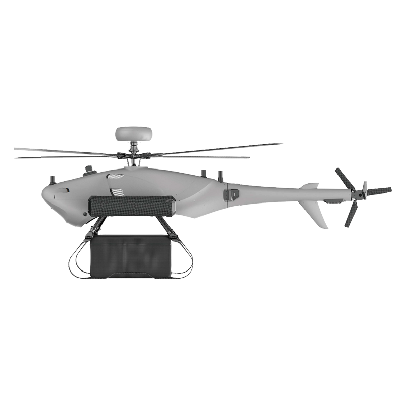
Wind resistance performance level 7 load capacity of 15kg Strong performance and efficient transportation Transport type Unmanned drone
Details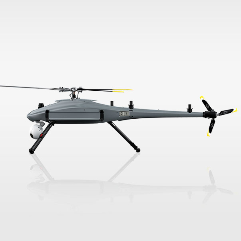
Fast enough, homework is more efficient. The unique advantage of variable pitch brings stronger and more stable flight performance, fearless of harsh operating environments.Integrated high-resolution infrared camera, 30x optical zoom camera,Lightweight and portable, single person operation is sufficient,Diversified payload.suitable for applications such as riot control and stability maintenance, cracking down on criminals, and security exercises
Details
This is a hybrid fixed- wing UAV system with excellent effective mounting capabilities. It is suitable for large-scale mission operations and can meet the needs of various missions such as aerial reconnaissance, maritime monitoring, firefighting, meteorology, emergency communication support, communication relay, material transportation, and special applications.
Details
This drone is designed specifically for heavy-duty transportation scenarios, with a body made of high-strength lightweight materials and modular structure that supports rapid folding and unfolding, balancing portability and operational efficiency. Equipped with an intelligent flight control system, it has one click takeoff and landing, autonomous cruise control, real-time route editing, and multi-mode emergency response functions, making it easy to meet the precise control needs in complex environments. Equipped with an efficient power system and multiple redundant safety designs, it meets the needs of short to medium distance material transportation, equipment lifting, and emergency tasks. The open task platform is adapted to professional scenarios such as surveying, inspection, and logistics, with real-time monitoring of flight status and high-precision hovering capabilities, further ensuring task safety and reliability.
Details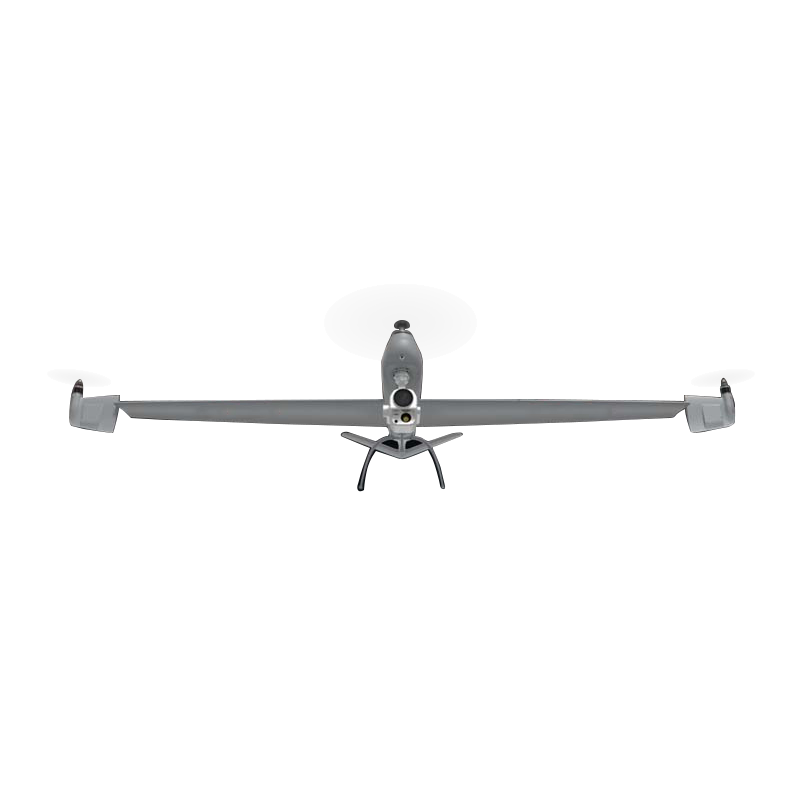
The Dragon Fish series of UAVs adopt a unique tilt-wingtip design, which effectively integrates the dual advantages of multi-rotor vertical take-off and landing and fixed-wing long-term endurance. It is maneuverable and flexible and can adapt to various complex take-off and landing conditions. The whole machine adopts quick-disassembly and efficient aerodynamic design, which makes the flight performance reach the industry-leading level while being portable and easy to use. The 30km dual-frequency high-definition image transmission realizes ultra-long-distance stable and worry-free operation. The industrial-grade flight control and navigation system ensures that the UAV can fly autonomously throughout the whole process, and it is equipped with different mounts such as dual-light cameras and tri-light cameras to meet the operation needs of different scenarios.
Details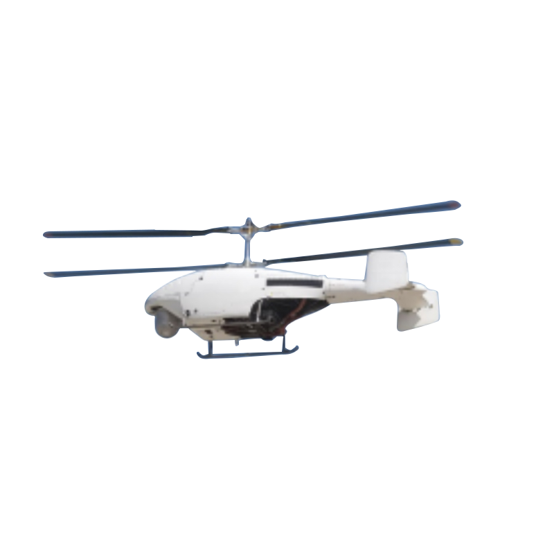
A high-altitude, high-speed, and heavy-load unmanned helicopter that can take off and land in high-altitude areas. It has the characteristics of high autonomy, strong expansion capability, good environmental adaptability, reliability and safety, and excellent flight performance. It can carry a variety of general and special mission payloads and has been widely used in emergency response, firefighting, logistics and transportation, forestry, grassland, electricity and other industries.
Details
The pipeline inspection micro drone is a micro drone designed for autonomous flight operations in urban integrated pipes such as sewage and rainwater pipelines in darkness and without GPS signals.
Details
The subway tunnel inspection drone is a patrol drone designed for autonomous flight operations in urban subway tunnels, highway tunnels, railway tunnels, and the bottom areas of highway and railway bridges.
Details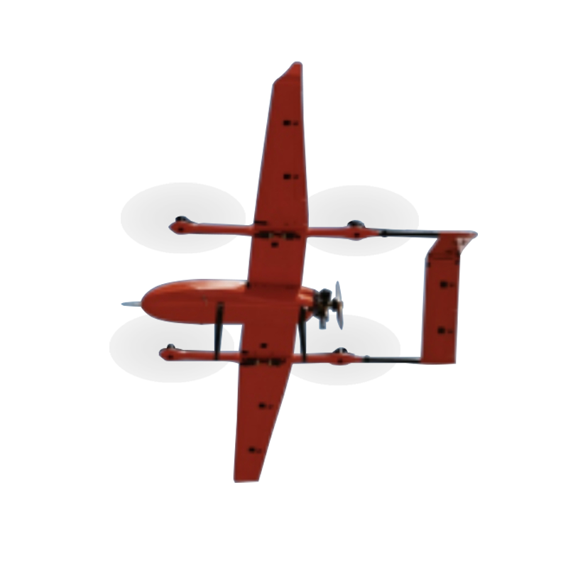
The vertical take-off and landing fixed-wing UAV is an industrial-grade large-scale UAV with advanced design and quick-detachable structure. It can operate in high-altitude and cold conditions, support flight missions in light to moderate rain environments, and has excellent safety.
Details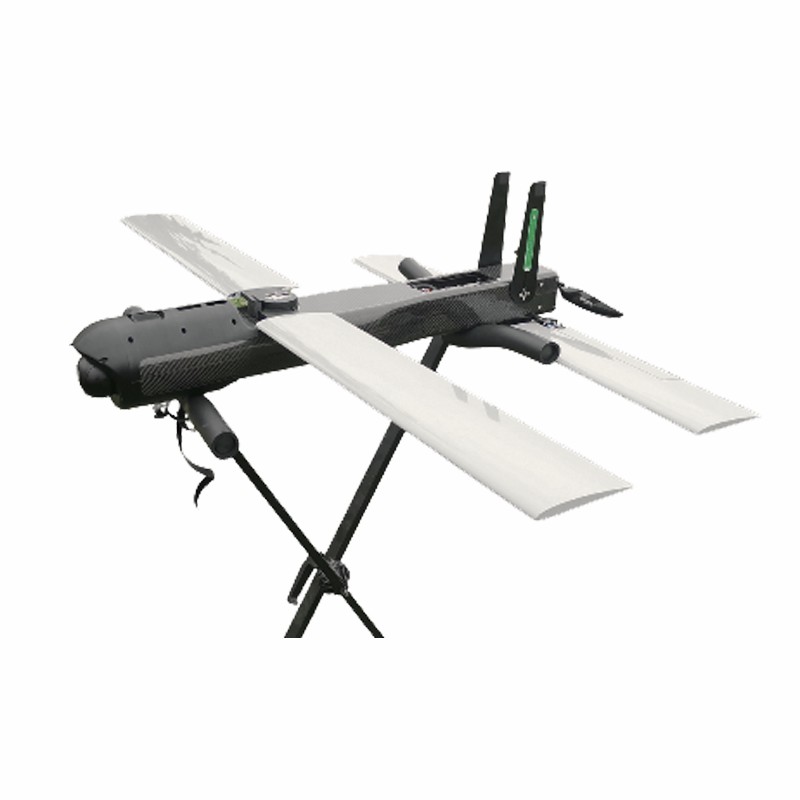
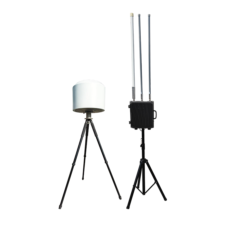
The integrated drone data link system is powerful and highly integrated, capable of simultaneously transmitting high-definition video, data, and SBUS signals. The transmission distance can be selected from 22km or 55km, and the ground end has a 1/4 screw mouth, which can be installed on a universal tripod. Users can connect the standard high-strength flexible cable to the ground station system to obtain the video and data of the drone.
Details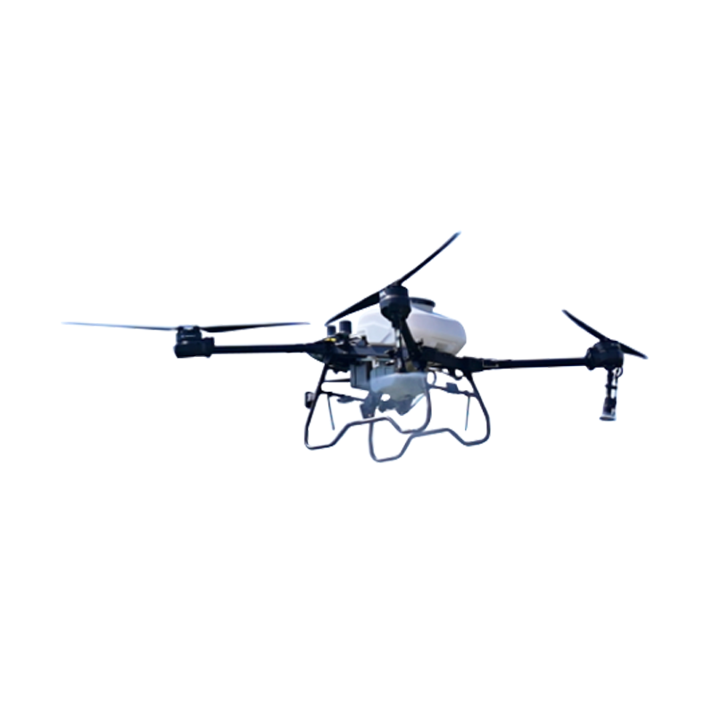
agricultural drone that integrates spraying, sowing, transportation and aerial surveying, specially tailored for the needs of modern agriculture . Equipped with a newly upgraded intelligent operation system and power system, it ensures more accurate and efficient operations. Designed with obstacle avoidance and terrain-following flight functions, it is suitable for different scenarios.
Details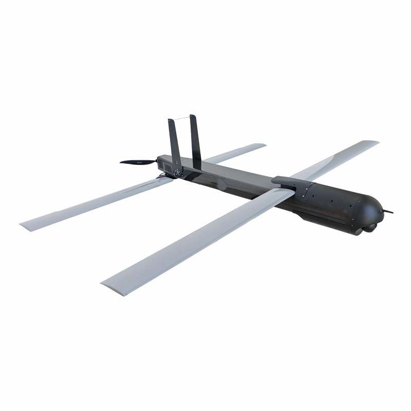
MK22/MK55 is an integrated drone data link system with powerful functions and high integration, capable of simultaneously transmitting high-definition video, data, and SBUS signals. The transmission distance can be selected as 22km or 55km, and the ground end has a 1/4 screw mouth that can be installed on a universal tripod. Users can connect the standard high-strength flexible cable to the ground station system to obtain the video and data of the drone.
Details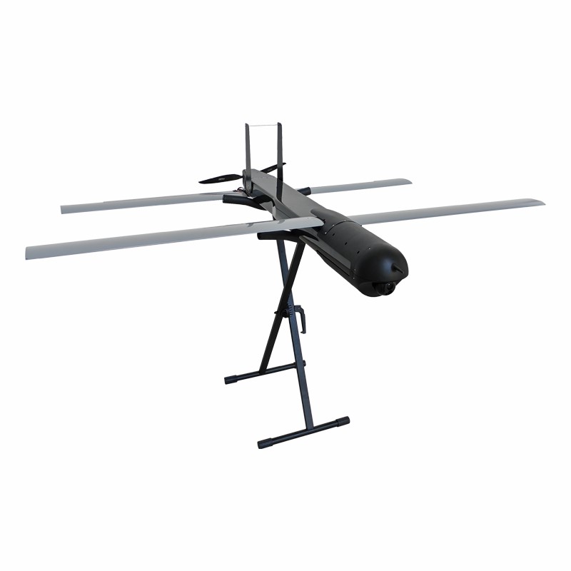
The main application scenario for drones is folding-wing drones, which are the product of the combination of advanced missile technology and drone technology, capable of rapidly reaching the target area and performing single or multiple tasks such as patrol flights, reconnaissance and surveillance, damage assessment, airborne wireless relay and target attack, and are a kind of intelligent munition with distinctive features that can meet the needs of future information-based operations. The signature feature of the folding-wing UAV is that it can fly on standby for long periods of time, and its flight range exceeds that of missiles of the same class.Compared with traditional missiles, the folded-wing UAV increases the depth of reconnaissance/strike, is easy to realize coordinated attacks with multiple munitions, can suppress and monitor a specific area, and is able to respond quickly to time-sensitive targets.
Details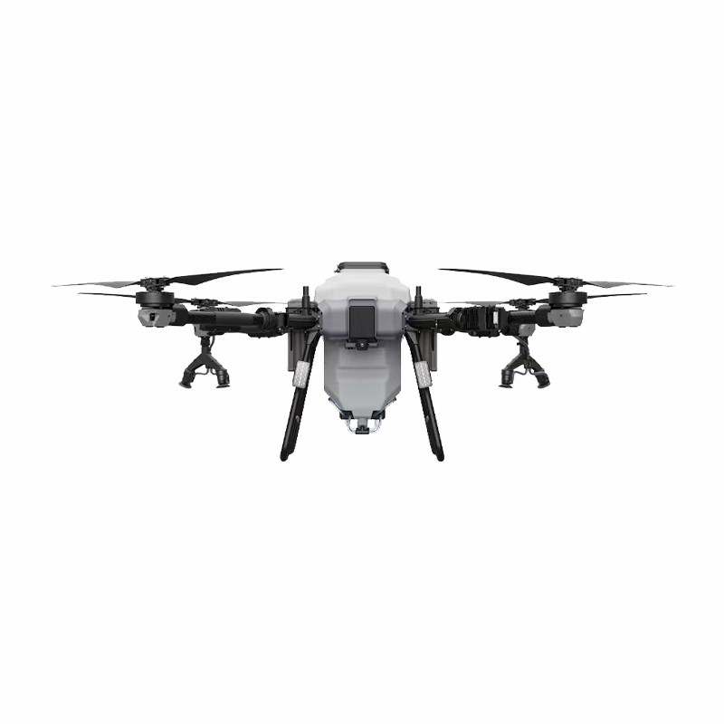
The whole drone is equipped with anti drop and protection, using a new generation of self-developed flight control system, with a frame made of aviation aluminum, arm connection lock buckle, stable structure, classic quadcopter, environmentally friendly folding making the special session easy, IP67 protection standard, no fear of pesticide and fertilizer corrosion, built-in UPS, no need to wait after battery replacement, ready to set sail immediately, split design, reducing interference, portable maintenance, multiple protection design, superior safety redundancy, electrically adjustable for quick disassembly, doubled power redundancy, good heat dissipation performance, and more stable flight operations.
Details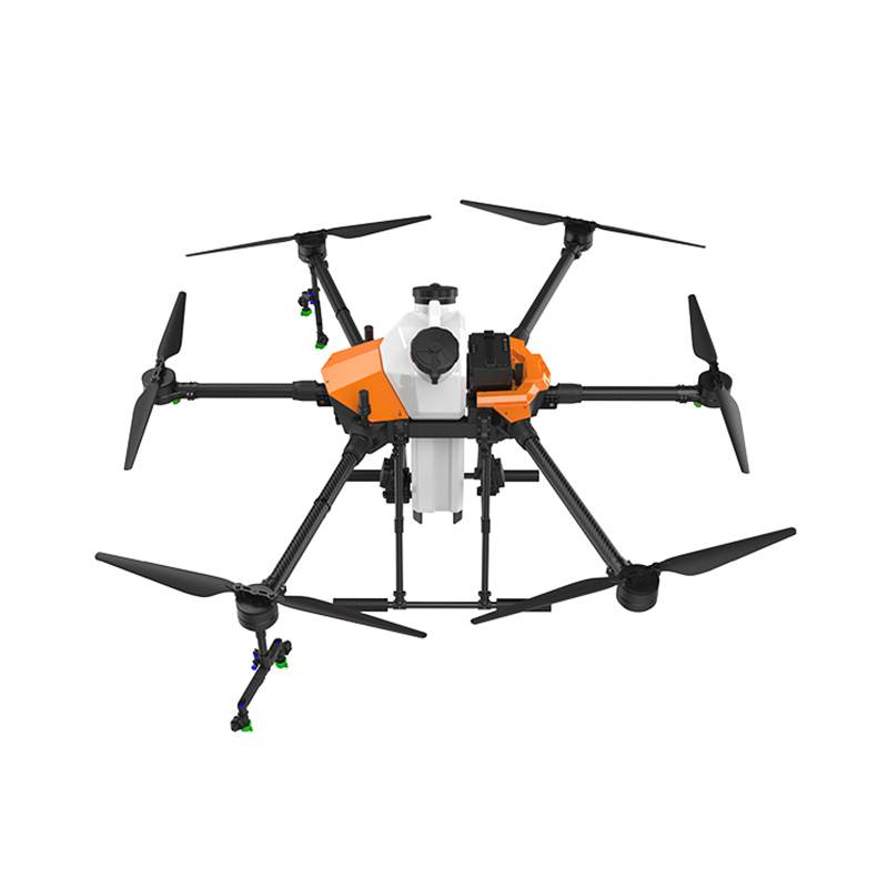
This 6-axis agricultural spraying drone revolutionizes crop care with multi-rotor crop protection stability, delivering millimeter-level accuracy across rice paddies, vineyards, and sloped fields. Equipped with precision foliar fertilization technology, it reduces chemical usage by 40% while achieving 95% droplet coverage through AI-powered wind compensation. As an eco-friendly pesticide application drone, its electrostatic spraying system minimizes environmental impact, passing ISO 14001 certification. The multi-terrain farming drone adapts to 45° inclines and 8m/s winds, offering low-cost agricultural UAV solutions that slash labor expenses by 60%. Compatible with liquid pesticides and nano-fertilizers, it's the ultimate smart farming tool for cooperative farms and plantation managers.
Details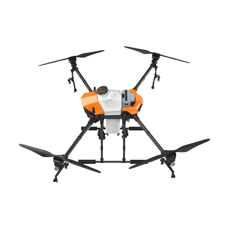
This autonomous agricultural spraying drone revolutionizes modern farming with AI-powered crop spraying technology, delivering millimeter-level accuracy across rice paddies, orchards, and sloped fields. Equipped with a multi-terrain pesticide spraying system, it adapts spraying parameters in real-time based on crop density and wind conditions, boosting precision crop protection efficiency by 40%. As a high-efficiency farming drone, it reduces chemical usage by 30% while covering 50 acres/hour, making it the ultimate cost-effective agricultural solution for large-scale plantations and cooperative farms. Compatible with organic and conventional pesticides, its smart navigation ensures complete drone for sale value realization through 24/7 operational readiness.
Details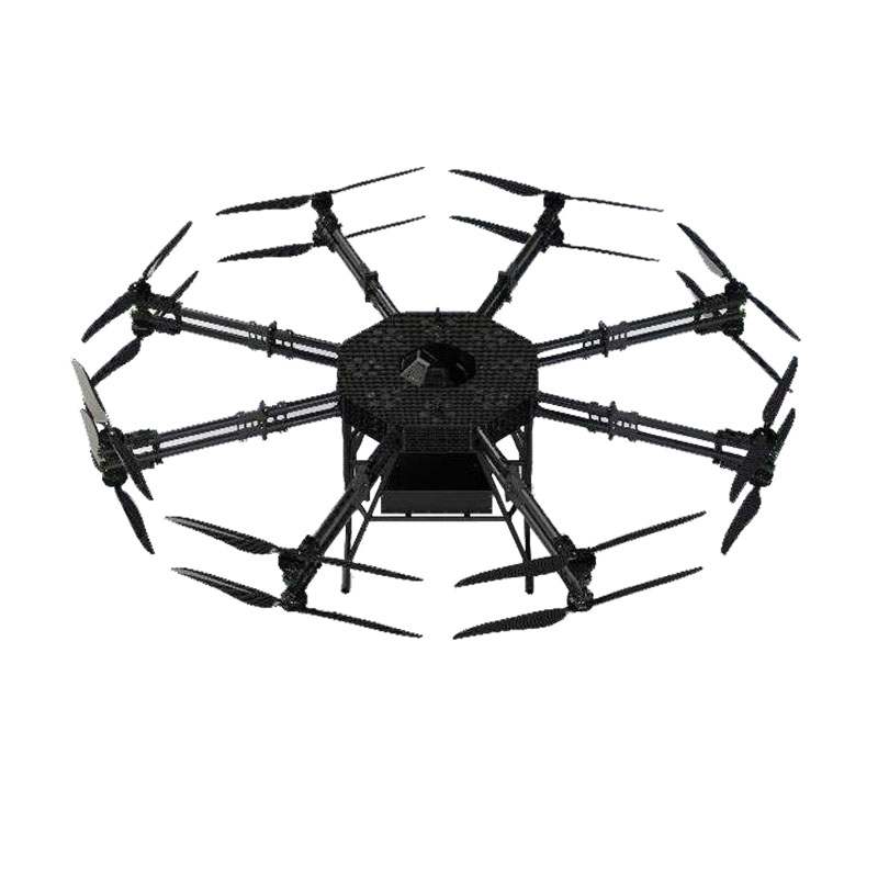
The YS-02 transport drone is ingeniously designed in terms of its body structure, adopting the concept of high strength and lightweight. Not only does it provide stable support for the body, but it also effectively reduces the overall weight. Further enhancing the body's impact resistance and durability. The power system, as the core of unmanned aerial vehicles, has a direct impact on their load capacity and flight performance.
Details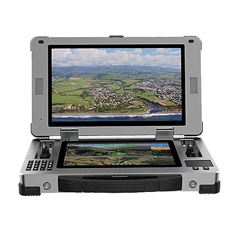
The dual screen ground station DMS-05 adopts a sturdy and durable industrial grade design, equipped with high-performance processors and large capacity storage to meet complex task requirements. Its touch screen supports multi touch, making it convenient for users to operate. The dual screen design provides high-definition display and high brightness screen, ensuring clear viewing of flight data and video images even in complex environments. The device supports various functions such as flight mode control, flight data recording and display, video display and follow-up, status monitoring, parameter binding, and trajectory planning. It is easy to operate and has comprehensive functions. In addition, the device also has functions such as voice prompts, fault alarms, and real-time monitoring to ensure flight safety. Suitable for various industrial scenarios such as inspection, surveying, rescue, etc., it is an ideal choice for drone operation. Its portability and reliability make it a trusted partner for professional users.
Details


 IPv6 network supported |
Sitemap
|
Xml
|
Blog
|
Privacy Policy
|
News
IPv6 network supported |
Sitemap
|
Xml
|
Blog
|
Privacy Policy
|
News
Our hours
Mon 11/21 - Wed 11/23: 9 AM - 8 PM
Thu 11/24: closed - Happy Thanksgiving!
Fri 11/25: 8 AM - 10 PM
Sat 11/26 - Sun 11/27: 10 AM - 9 PM
(all hours are Eastern Time)