Drone Chemical Plant Inclined Photography Highway Modeling Bridge Mapping Pipeline Inspection Port Mapping
With the advantages of fast and efficient, mobile and flexible, low cost, etc., the drone tilt photography technology is slowly subverting the traditional surveying and mapping mode of operation, and has become the "new favorite" of the surveying and mapping industry. Applying the tilt photography technology to the drone is actually doing a three-dimensional model, and the establishment of this model is more real, more intuitive, moreconform to the reality.
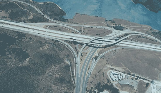
Highway mapping
The first step in the maintenance and improvement of a large-scale transportation infrastructure such as a highway is to obtain clear images of the entire roadway.In the past, this large-scale task was usually accomplished manually or by helicopter.While manual inspections take too long and helicopter inspections are too costly, drones are the best choice for road mapping because of their low cost, high efficiency and high accuracy.Qifei's UAV mapping system integrates a mapping drone (fixed wing/multi-rotor), 3D modeling software (PIX4D), and GIS application (RisingSpace GIS Smart City Software System), which, together with Qifei's powerful workstations, can efficiently complete the mapping work and at the same time can also be used to reconstruct the amount of road reconstruction work through Qifei's GIS application software.The GIS application software of Qifei Application can also accurately assess the amount of road reconstruction works and simulate the scene effects and possible impacts on the surrounding environment after the reconstruction works, which can provide strong support for the road reconstruction and road planning of the highway department.
-----------------------------

Bridge Inspection
Bridge inspection is mainly for its appearance and structural performance inspection and evaluation, usually the performance of the structure of the inspection is completed through a series of mechanical tests, while the inspection of its appearance mainly rely on the naked eye or auxiliary tools (such as bridge inspection vehicle, binoculars, etc.) to detect the main components of the bridge whether there are cracks, cracks, cracks, corrosion of the exposed tendons, bearings, such as hollowing and other diseases.The traditional bridge inspection mostly utilizes relevant special instruments to measure, record and count the various parts of the bridge, during which the maintenance personnel need to hang under the bridge or start the inspection from the elevated platform.For special structural bridges (such as cable-stayed bridges, suspension bridges, steel and concrete arch bridges, etc.) or large-span high-pier bridges, the traditional inspection tools basically can not come in handy, can only return to the original form of manual inspection.Artificial inspection operations, not only low efficiency, difficulty, high risk factor, and the detection of fine degree is far from enough, and the application of drone technology, will to a large extent to solve this problem.The drone can complete the filming and forensics of the structural surface of the bridge bottom surface, column surface and beams through the camera, LIDAR and other control equipment, and at the same time, it can also carry out the three-dimensional modeling of the bridge as a whole, and measure the external structure of the bridge through the model for the professionals to analyze the bridge status and find out the dangerous situation in time, which can greatly reduce the work intensity of the bridge maintenance personnel and improve the efficiency of the bridge inspection and maintenance.
-----------------------------
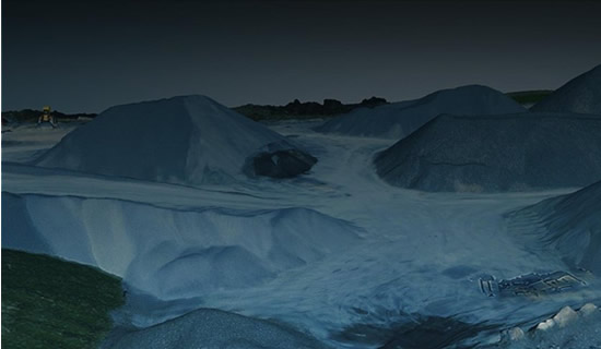
Stack Measurement
The application scope of heap measurement is very wide, mines, thermal power plants, soil and sand piles in the construction process of building projects, bulk cargo estimation in ports and harbors, as well as grain piles in grain silos, which can not be separated from the heap measurement technology.Currently, the heap measurement, mainly relying on total station, disk coal meter, GPS and other measuring instruments to measure the heap, compared to earlier completely rely on manual use of tape measure, these measurement methods have made great progress.However, nowadays there is a more efficient and high-precision measurement method: the use of drones for mapping and modeling.The drone can preset routes, automatically work over the operating area to collect data, and after collecting the data, it can be imported into Qifei's self-developed GIS system, which can generate point clouds and 3D modeling data with a single click, according to which it can carry out measurements of spatial distances, volumes, or simulated measurements of slopes and other areas of irregular piles, so as to provide accurate numerical references for engineering construction planning and production operations.
-----------------------------
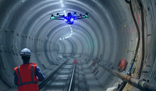
Tunnel and pipeline inspection
Traditional subway, railroad and automobile tunnel inspection requires inspectors to go deep into the tunnel and manually check whether there are cracks or water leaks and other abnormalities, and to ensure that there are no problems with the tunnel structure.This approach is overly dependent on manpower, low efficiency and certain safety risks, as a transportation corridor of the subway, railroad and automobile tunnels, leaving the inspector's gap time is also very limited, which further increases the difficulty of the inspection work.The use of drones equipped with high-definition cameras and inspection equipment such as LIDAR, which can collect high-precision image data and generate 3D models of the tunnels for viewing at any time, not only provides higher inspection accuracy, but also allows engineers to have more time to focus on analyzing the information collected and quickly put forward the countermeasures that need to be taken.
-----------------------------
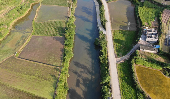
Land titling
Traditional land rights surveying work is generally done by measuring topographic maps by means of ground engineering surveys or aerial topographic maps by means of traditional manned airplanes.Compared with the traditional way, the aerial photogrammetry survey by UAV has obvious advantages, low cost, convenient execution, high degree of automation, high efficiency and high accuracy.Therefore, it is a more feasible way to obtain basic topographic map data through aerial photographic modeling by UAV in the work of collective land registration and licensing in rural areas.The UAV applied by Qifei is equipped with a five-lens camera, which can carry out data collection and image shooting on large areas within the scope of rural collective land, obtain high-precision three-dimensional data on the ground surface, and then carry out rapid three-dimensional modeling through the side-view image of collaborative operations to draw topographic maps with larger scale, so as to help the work of confirming the right to register and issue certificates of ownership of rural collective land to be carried out smoothly.
-----------------------------
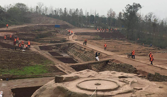
Archaeological restoration
Drone 3D modeling technology can also be used for archaeological and cultural relics restoration work.Three-dimensional scanning technology using surface data acquisition instead of the traditional point data acquisition, through high-speed laser measurement methods, fast, accurate, comprehensive access to the object's three-dimensional information, true record of the real three-dimensional information of cultural relics, the establishment of three-dimensional models, from the traditional manual measurement into the indoor computer on the point cloud data of high-precision measurements, with non-contact, avoiding the destruction of cultural relics.Some of the larger cultural relics building up to dozens of meters, not only a huge amount of work and complex ornamentation and key areas and other difficult to record, the traditional mapping is very difficult, but through the three-dimensional panoramic scanning, the use of point cloud can accurately respond to the spatial location, with the value of the color of the high-density point cloud to achieve the visualization of the information.These technologies can be used to improve the accuracy of cultural relics restoration and pre-judgment, select the means of protection to be used, while shortening the restoration period;
-----------------------------
Our hours
Mon 11/21 - Wed 11/23: 9 AM - 8 PM
Thu 11/24: closed - Happy Thanksgiving!
Fri 11/25: 8 AM - 10 PM
Sat 11/26 - Sun 11/27: 10 AM - 9 PM
(all hours are Eastern Time)