Fixed-wing UAV + Dual-sensor Pod + UAV Platform Software
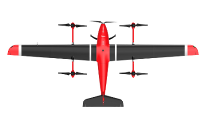
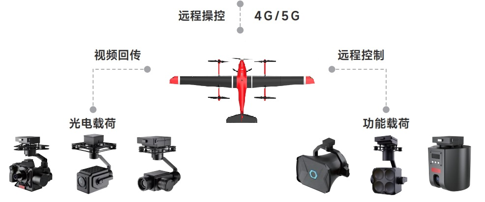
A pure electric composite wing vertical takeoff and landing fixed wing, equipped with a standard quick release system, can quickly replace loads according to mission requirements. The product supports task systems such as visible light, dual light, infrared, and high-definition cameras. In the field of security, it can be used for high-altitude reconnaissance, border patrol, and forest fire prevention; In the energy field, it can be used for long-distance oil and gas pipeline inspections, power line inspections, etc.
|
Technical Parameters |
|
|
Main material |
composite material |
|
Expand max size (including propeller ) |
Wheelbase 3399mm、length 1495mm、height 515mm |
|
Body weight |
9.15kg (not including battery and payload) |
|
Empty weight |
14.25kg |
|
Max payload |
3kg |
|
Idle endurance time |
150min |
|
Maximum wind resistance capability |
6级 (fixed wing mode) |
|
Image transmission distance |
30km(50km optional) |
|
Working temperature |
-20-C-60-c |
|
Working humidity |
10%~90% without condensation |
|
Protection level |
IP54 |
|
Altitude limit |
5000m |
|
Cruise speed |
19-20m/s |
|
Maximum flight speed |
35m/s |
|
The above parameters are for reference only. Detailed product parameters are subject to actual delivery. |
|
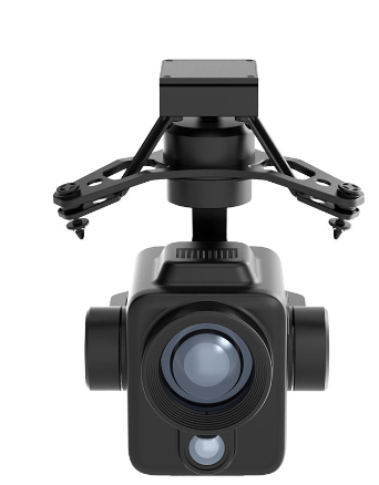
PTZ is a high-definition infrared dual light pod developed and produced by our company. The pod integrates 1280 * 1024 pixel high-definition infrared and 4K visible light modules to ensure customers can have a better picture quality experience both day and night; Its 1K high resolution is four times higher than the conventional infrared resolution in the industry, truly achieving "no detail in sight", facilitating infrared defect detection and recognition under special environmental conditions, effectively improving the infrared inspection level and AI algorithm defect recognition accuracy of high-voltage AC/DC transmission lines, and can be widely applied in industries such as power inspection, oil pipeline inspection, photovoltaic inspection, urban fire protection, forest fire protection, etc., helping users to open up efficient day and night operation modes.
|
Technical Parameters |
|
|
Total weight |
1200g |
|
size |
178mm*157.5mm*210mm |
|
Installation method |
Drawer style quick release |
|
Gimbal three-axis stabilization system |
Direction, roll, pitch |
|
Structural limit |
Directional axis:- 330°~+330° |
|
Remote control angle |
Horizontal roller:- 70°~+70° |
|
Total weight |
Pitch axis:- 135°~+45° |
|
size |
Directional axis:- 270°~+270° |
|
Installation method |
Pitch axis:- 90°~+30° |
|
Maximum rotational speed |
100 °/s (adjustable) |
|
Image stabilization accuracy |
≤0.01° |
|
resolving power |
Infrared 1280 * 1024 |
|
focal length |
visible light |
|
Field of view angle |
Photo: 48MP Video: 4K@30fps |
|
working temperature |
-20℃C-55℃C |
|
The above parameters are for reference only. Detailed product parameters are subject to actual delivery. |
|
Industry application of PAAS enables drones to have more sensitive situational awareness, intelligent AI capabilities, and efficient information aggregation in scene applications, empowering social production and life efficiency progress.
Based on global imaging base maps, AI intelligent algorithms, and cloud computing services, integrating unmanned aerial vehicle industry application systems, we provide a one-stop solution for collaborative management of flight platforms, front-end operators, and back-end command centers. At the same time, we have cloud processing and analysis capabilities for multiple data results such as geographic information semantics and intelligent annotation of live broadcast images.




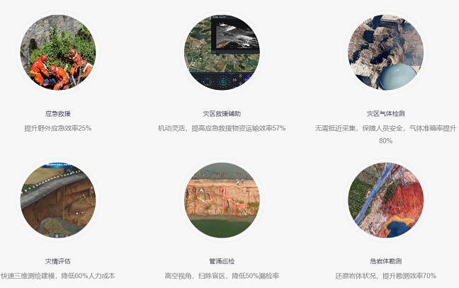
At the scene of the accident, the drone was equipped with gas detection equipment to quickly collect air samples and transmit real-time data to the command center. Through a visual interface, rescue personnel can remotely monitor the distribution of gas concentration on site, avoiding direct exposure to harmful environments and providing decision-making basis for rescue operations to ensure personnel safety.
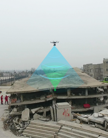
In disaster areas where communication base stations are damaged or signal coverage is insufficient, drones are equipped with communication relay devices to quickly establish temporary communication links and achieve real-time sharing of on-site audio, video, and other data information. Drones, as mobile communication nodes, solve communication problems in complex environments and provide basic support for emergency command and rescue operations.
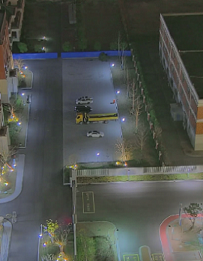
Drones are equipped with infrared thermal imaging cameras and high-definition cameras to conduct large-scale searches in disaster areas and quickly locate trapped individuals. Through real-time image transmission and AI recognition technology, drones can mark the location of trapped individuals and transmit information to rescue teams in real time, significantly improving search and rescue efficiency and ensuring the safety of trapped and rescue personnel.
2.4 Survey of Dangerous Rock Masses
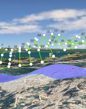
In areas prone to geological hazards, drones are equipped with high-definition cameras and Lidar to conduct close range surveys of dangerous rock formations. By generating high-precision 3D models, geological experts can be provided with detailed rock conditions to assist in the rapid development of remediation plans, improve survey efficiency, and enhance decision-making scientificity.
Our hours
Mon 11/21 - Wed 11/23: 9 AM - 8 PM
Thu 11/24: closed - Happy Thanksgiving!
Fri 11/25: 8 AM - 10 PM
Sat 11/26 - Sun 11/27: 10 AM - 9 PM
(all hours are Eastern Time)